
Trace a West Springfield Street by Address
A West Springfield street search works best as a short record trail, not as a person roster. Begin with the physical parcel, then use the parcel reference to find the deed. That sequence separates an assessment snapshot from title evidence. The Town GIS can then supply street, parcel, address-point, and district context. A municipal voter file and the individual Massachusetts voter-status search serve different purposes, so a name-and-date-based status check cannot be used as a reverse lookup for every address on a street.
- Enter the address or known PIN, the local parcel identifier, in the West Springfield AxisGIS property viewer. Save the parcel identifier, situs address or physical parcel location, registry book and page reference, and the date checked.
- Open the local parcel map and inspect the selected parcel with address points, streets, and relevant boundary layers enabled. Record adjacent parcel IDs rather than assuming adjacent homes share a record.
- Follow the registry book and page to the Hampden County Registry of Deeds. Treat the recorded image as the title lead, not the assessed-owner field alone.
- For a dated residence question, use the Town Clerk or Board of Registrars route for the permitted municipal record. The statewide status form requires an individual name, date of birth, and ZIP.
- When the question reaches an earlier household, search the Bertera History Room's reverse or criss-cross directory material by street and number, then compare nearby numbers and the publisher key.
Each step answers a narrower question. The result may be a parcel owner, a title party, an address-point relationship, a voter-record result, or a historical occupant. Labeling the role and date prevents an address trail from turning into an unsupported conclusion.
West Springfield Street Directory Fields
The West Springfield AxisGIS Property Viewer is the municipal starting point for an address or PIN. Its public splash screen describes geographic and tax-record information and says it is informational, not a substitute for a survey. The verified PIN pattern is 000-00000-00-000. Its configured parcel data carries a 2023 label, so a record found there may predate a newer deed, permit, or assessment action.
| AxisGIS or GIS field | How it helps a street search |
|---|---|
| PIN / PropertyID | Connects a street address to the municipal parcel record. |
| Situs address | Shows the physical parcel location, not necessarily a mailing destination. |
| Owner primary / secondary | Provides a dated ownership field, not a complete resident list. |
| Registry book / page | Supplies a lead for the deed image at the Registry. |
| Map / block / lot | Helps compare a current parcel with a plan or older legal description. |
| Use code / zoning | Describes administrative land classification, not who is present. |
The West Springfield Assessors office identifies the municipal assessment route and links to the viewer. The captured office page below is a source reference, not evidence about a particular address.
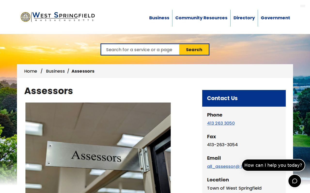
The assessment route is useful for parcel discovery. A legal-boundary or title question still needs the recorded document and, when necessary, a recorded plan or qualified professional.
West Springfield Street GIS Layers
For a street-by-street view, the Town's Open Data and GIS catalog and its parcel services separate map geometry from title. The parcel ownership FeatureServer includes owner and mailing fields, RegistryBook, RegistryPage, most recent list and sale references, map, block, lot, assessed values, PropertyID, use code, zoning, and geometry. ArcGIS queries can return JSON, GeoJSON, or PBF and have a stated maximum record count of 1,000. Preserve the query date and a narrow extent because layer data can change.
A careful West Springfield street-by-street view turns on parcels and address points first. Add old parcel lines, rights of way, buildings, zoning, flood, historic-district, school-district, or voting-district layers only when they answer the specific location question. An apparent next-door feature may instead be a condominium unit, town parcel, driveway, right of way, or unbuildable land. The map describes municipal geography and does not certify a boundary.
The parcel ownership layer metadata documents the fields without selecting a private parcel. Its capture below shows the kind of public schema available for address research.
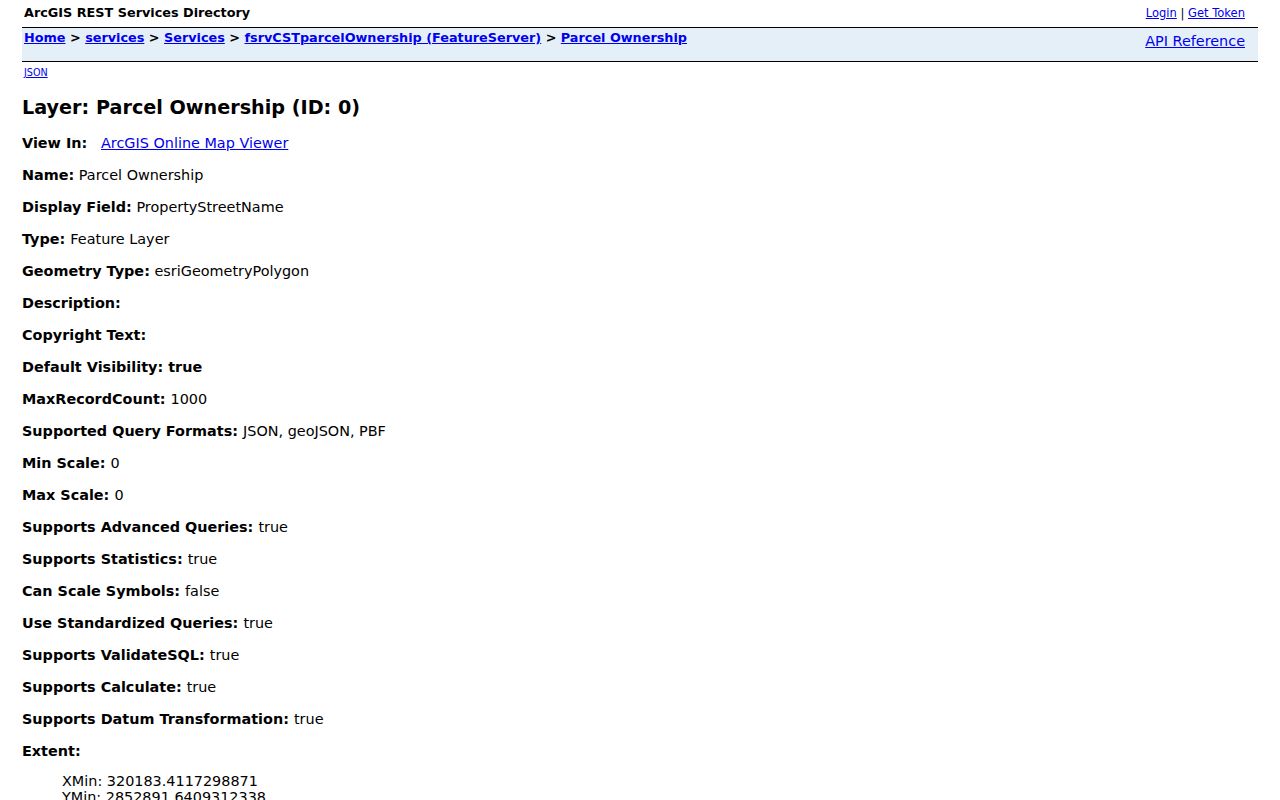
Use a parcel identifier to connect sources, but do not silently merge an owner mailing address, a directory occupant, and a voter record into a single household claim.
West Springfield Street Records Compared
Address-keyed records have different keepers and different limits. They can be compared, provided each result keeps its role. Assessment and GIS records are discovery tools. The Registry is the title-record authority. Permits describe projects and applicants, while local voter material follows separate statutory access rules. The historical directory collection gives a dated occupancy clue rather than a current status.
| Address record | Custodian | Street-level evidence | Access route |
|---|---|---|---|
| Assessment parcel | West Springfield Assessors | PIN, situs, owner and tax-mailing fields, value, use, zoning, registry reference | AxisGIS informational viewer |
| Parcel ownership GIS | Town GIS | Parcel geometry, Map/Block/Lot, owner fields, registry reference, zoning | Public ArcGIS service with query limits |
| Recorded Land | Hampden County Registry of Deeds | Transfers, plans, liens, mortgages, releases, grantor and grantee | Online index and document images |
| Building permits | Town Building Department / GIS | Project type, dates, status, work description, applicant or contractor role | Public permit layer and OpenGov route |
| Municipal voter record | Town Clerk / Registrars | Permitted public voter-list fields for a specified record | Municipal request, subject to state rules |
| Reverse directory | Bertera History Room | Historical address-to-occupant and occupation clues | In-room research |
Massachusetts Public Records Law, G.L. c.66 §10, is a route for existing municipal records, subject to exemptions. A focused request for a permit file or other named record is more workable than asking an office to create a list of all residents on a street. Written requests are preferred, and the state guidance generally provides a ten-business-day response framework.
Deed Trails Along a West Springfield Street
The Hampden Registry search instructions divide land research into Recorded Land and Registered Land. For Recorded Land after January 1, 1948, the Registry documents searches by name, address, book and page, year and instrument number, and entry date. West Springfield uses the municipality code W S. Earlier material calls for a scanned Grantor/Grantee index, then the extracted book and page. A missing address result is not proof that a deed vanished.
The registry instructions image is a useful reminder that search mode matters. It shows the documented route rather than a private deed result.
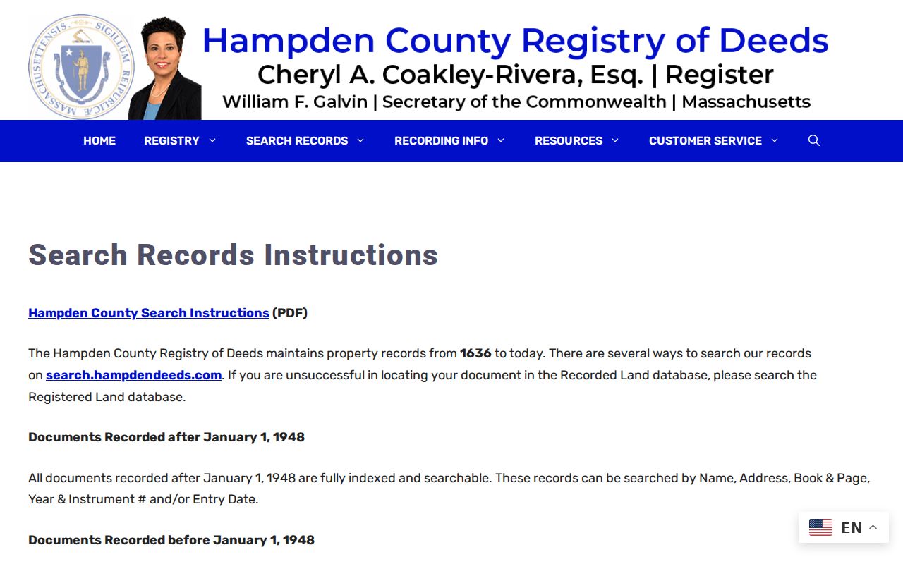
Once a book and page is known, compare the grantor, grantee, instrument type, entry date, and plan reference before deciding that a document concerns the same street parcel.
The Hampden deed search portal provides the Registry's public search route. It is also where the Recorded Land and Registered Land choice must be checked rather than assumed from a street address.
Registry records extend from 1636 to the present, but indexing changes at the 1948 breakpoint. That contrast is an important West Springfield address-research comparison: a modern search can be address-led, while an earlier one may need the party index and a manual book-and-page bridge.
Permit Clues for West Springfield Streets
Permit information adds project context to an address, not proof of residence or ownership. The municipal permit service can include a permit number or type, project description, applicant or contractor role, project cost, issue and expiration dates, and final status. Link the permit to its parcel or address point, then state the role exactly as the record gives it. The research did not verify a complete historical start date for the public permit layer.
The West Springfield building-permits layer is shown below as a schema-level reference. It should be searched without republishing a private applicant record.
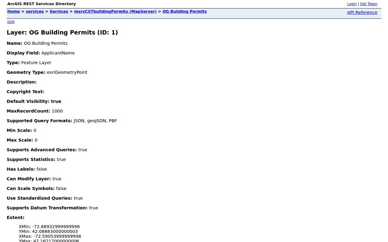
A permit can help date work on a parcel. It cannot establish who occupied the property before or after that work.
West Springfield Address Names and Parcels
One address string can describe several different things. Keeping the terms apart makes an address search more reliable, especially when a deed uses a lot or plan and a tax record uses a current mailing address. USPS validates mailing form, the municipal map places the situs, and the Registry documents the land transfer.
- Parcel
- A mapped unit of land used in the assessment and GIS systems. Its visible boundary is informational, not a survey.
- Situs address
- The physical location of a parcel. It can differ from the owner's mailing address.
- Legal description
- The lot, plan, metes-and-bounds, unit, or other land description in a title document. It is often more durable than a street number.
- Criss-cross directory
- A reverse-style directory arranged to help connect an address with a historical listed occupant. Check the volume's key before interpreting any entry.
The exact authority for E911 addressing was not verified. If an address discrepancy matters, route it to Town GIS, the Assessors, or the Town Clerk instead of guessing which office assigned the number.
The West Springfield Collector-Treasurer route also distinguishes a bill search from a title record. Its online billpay guidance uses a bill number and tax year, while a municipal lien certificate follows a separate mail request.
The Collector-Treasurer screen supports a parcel-related billing question. It does not change the need to confirm ownership and title through the Registry of Deeds.
West Springfield Street History Checks
Older address work needs a geography check before a name match. West Springfield separated from Springfield in 1774 and gained a tract from Westfield in 1802. A historical record using Springfield may reflect the jurisdiction or regional setting at the time, not an error. West Springfield became a city in 2000, yet municipal materials often retain Town of West Springfield wording. Search both forms when a catalog or directory title seems inconsistent.
The verified record history documents boundary change, not a local street-renumbering calendar. No official index of street renamings, house-number conversions, or E911 changes was located. Compare the old street spelling, adjacent numbers, a legal description, map/block/lot, and the current PIN. The 1795 plan and 1831 J. Lathrop plans can help place historic road language beside modern GIS, but cannot prove a current legal boundary.
West Springfield is across the Connecticut River from Springfield, where the county seat and Registry service center are located. A source with a Springfield address or heading should be checked against the municipality, street, ZIP, and date before it is attached to a West Springfield street.
Voter Geography Near West Springfield Streets
The Massachusetts voter status search confirms an individual's status through first name, last name, date of birth, ZIP, and an agreement checkbox. It is not an address-wide search. The Town Clerk and Board of Registrars handle the separate municipal voter-file route, while the state rules distinguish municipal public fields from a statewide voter file that is not public.
A voting-district layer or precinct map can locate a parcel in election geography. It cannot name a complete household. West Springfield has eight precincts, and precincts are electoral units rather than neighborhood names. Protected voters and Address Confidentiality Program participants may not appear in the same way as ordinary records, so an omission is not evidence that someone does not live nearby.
West Springfield Street Directory Limits
A West Springfield street directory cannot establish every person at an address. Parcel ownership and tax-mailing fields may point outside the town or to a trust, estate, or business. A deed names transaction parties. A permit names a project participant. The individual voter form cannot be reversed by address, and utility customer lists, delivery-route information, full household composition, and private association membership were not located as public sources. Historical directory entries are dated evidence, not a present-day roster.
Massachusetts law also protects some address information. Protected voter mechanisms under MGL c.51 §37 and the Address Confidentiality Program limit what a public index may reveal. When a request is needed, ask for an existing, defined record and preserve only the information necessary for the historical, property, family, or civic question.
Lawful use. West Springfield address records support personal research, family history, property questions, and civic understanding. Do not use a record trail to stalk, threaten, harass, or contact a living person against their wishes.
For historical household work, the West Springfield city directory collections provide the fuller collection context. The strongest result remains a dated trail with source labels, not a compiled list of people.